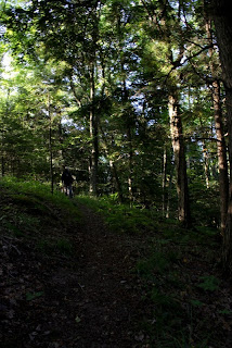
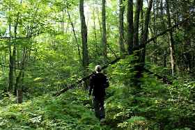
*Please adjust your screen's brightness to view these photos.
 |
| Lost Lake Esker State Natural Area, Jerry Lake Segment of Ice Age Trail |
 |
| We started from left to right, 3 miles one way. We did 6 miles in/out hike. Map courtesy of Google Maps and Iceagetrail.org |
August 17th, 2013
While visiting some friends near
Medford, WI, M planned a hike on the
Ice Age National Scenic Trail. M was interested in hiking the Jerry Lake Segment that was featured in
High Point Chapter of the Ice Age Trail Companion Guide. We started the hike at Lost Lake Esker State Natural area, in the middle of the Jerry Lake Segment, because the trail had us hiking on top of an
esker. The esker, a ridge of sediment and gravel, was formed during the Wisconsin glaciation/ice age. Though we intended to do a 13 mile hike, we were only able to do 6 miles in and out due to the influx of mosquitoes and heat/humidity.
From Highway M, we drove 4-5 miles down the gravel road, Sailor Creek, until we found our trail head. The first part of the trail was flat but the terrain ascended quickly and we found ourselves on top of the esker in no time. It was a gorgeous hike with two seemingly different ecosystems on either side of the esker. The trail was well maintained with some areas featuring large ferns growing over the pathway, but other than that, there were rarely any obstacles along the hike. The hemlock grove switched into birch and then into a mix of conifers, snaking alongside the ridge and undulating with each valley or esker-top. Once we were a mile in, the esker waned and the trail diverted us north.
This northern section was still wooded and took us through forests littered with pine needles. The looming trees and cleared out forest floor were a breath of fresh air since we were able to lose some of the mosquitoes. This break only lasted a short while as we soon crossed over to woods with more undergrowth. The undergrowth was surreal since I have never hiked in an area so verdant especially in Wisconsin. It looked like a scene from Lord of the Rings...maybe no Ents but definitely a very ancient feel to it. The pines broke away as we neared the Chippewa Lobe Interpretive Loop.
The trees were shorter and over the edge of the foliage, we could see a clearing...possibly a bog. The ground was no longer dry but soft and soggy. More bugs came out to pester us in this damp region and, though it was as lush as a rain forest, we sped up our pace to avoid getting bit. We quickly hiked around the bog and came upon the sign for the Chippewa Lobe Interpretive Trail. We knew then that we were only 3 miles in and still had a 7 mile loop before we could go back to our car. Feeling the heat and the bites from the mosquitoes, we turned around and hiked back to the car. If we would have remembered to bring our DEET and if I brought my backpack so we had two packs instead of one, I think we would have trudged through the mosquito infested trail. However, there's always next time especially since this is such a pristine area. This entire hike was definitely worth all the bites!
 |
| Trail head |
 |
| Starting our hike. Yellow blazes mark the Ice Age National Scenic Trail |
 |
| Primordial forest |
 |
| Trail was well maintained though there was overgrowth in some areas |
 |
| Very cool tree |
 |
| Ice Age National Scenic Trail, love seeing these! |
 |
| Slight switchback to climb up the esker riddled with hemlock trees |
 |
| Ascending the esker |
 |
| Sides of the esker ridge with hemlock grove |
 |
| Trail on top of esker |
 |
| Right side of trail |
 |
| Left side of trail |
 |
| Hemlock varnish shelf fungus (Ganoderma tsugae) |
 |
| Another view off the steep esker |
 |
| Yellow blazes = Ice Age Trail |
 |
| Ridiculously gorgeous glacial rock. It might not seem special but this rock probably traveled on the glacier for thousands of miles before it was deposited here. |
 |
| Trail starting the clear out |
 |
| Ice Age Trail |
 |
| Bench on top of esker |
 |
| Descending first esker and will go up a 2nd ridge |
 |
| M on the trail with the tall trees looming overhead |
 |
| Trail becomes more overgrown and trees start changing from pines to deciduous trees |
 |
| Trail is easy to follow |
 |
| More growth over trail but still manageable |
 |
| Down tree but easy to get around |
 |
| Off the esker and onto boardwalk over lower lying ground and crosses a stream too. |
 |
| Ice Age Trail |
 |
| Tiny little plants. Will update with name when I figure it out |
 |
| Ice Age Trail |
 |
| Ferns growing over the trail, up to my hip in height! |
 |
| Back to smaller underbrush |
 |
| Getting closer to the bog |
 |
| Ice Age Trail, twigs places in a wet spot. The twigs were slippery and moved easily so I almost tripped walking over these |
 |
| Another boardwalk along the Ice Age Trail |
 |
| This forest floor was the best! Clear = no mosquitoes! |
 |
| Back to the underbrush |
 |
| Underbrush is more grassy as we get nearer to the bog |
 |
| Crossed the forest road 108, also known as Lake 19 Rd |
 |
| Back to the Ice Age Trail |
 |
| Terrain changes |
 |
| More mosquitoes in this area |
 |
| Lush almost tropical! Only in WI :) |
 |
| Hiking alongside the bog on the Ice Age Trail |
 |
| Rounding the bog |
 |
| Uphill again |
 |
| Clearing behind the foliage is a bog |
 |
| We didn't do this loop since the bugs were too intense but we will have to do this next time! |
 |
| Heading back to the car and through all the bugs as the temps started going up. |


No comments:
Post a Comment